


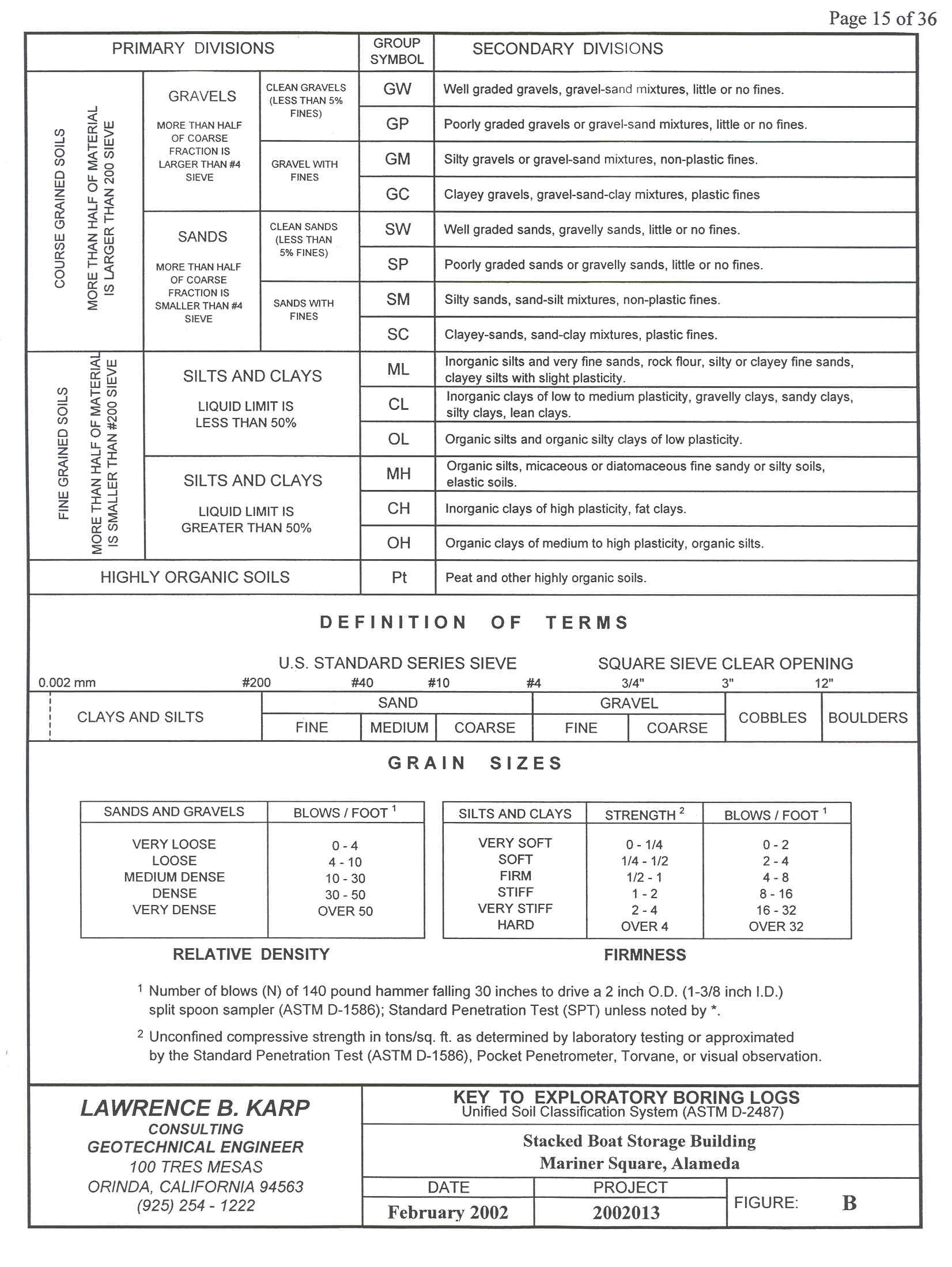
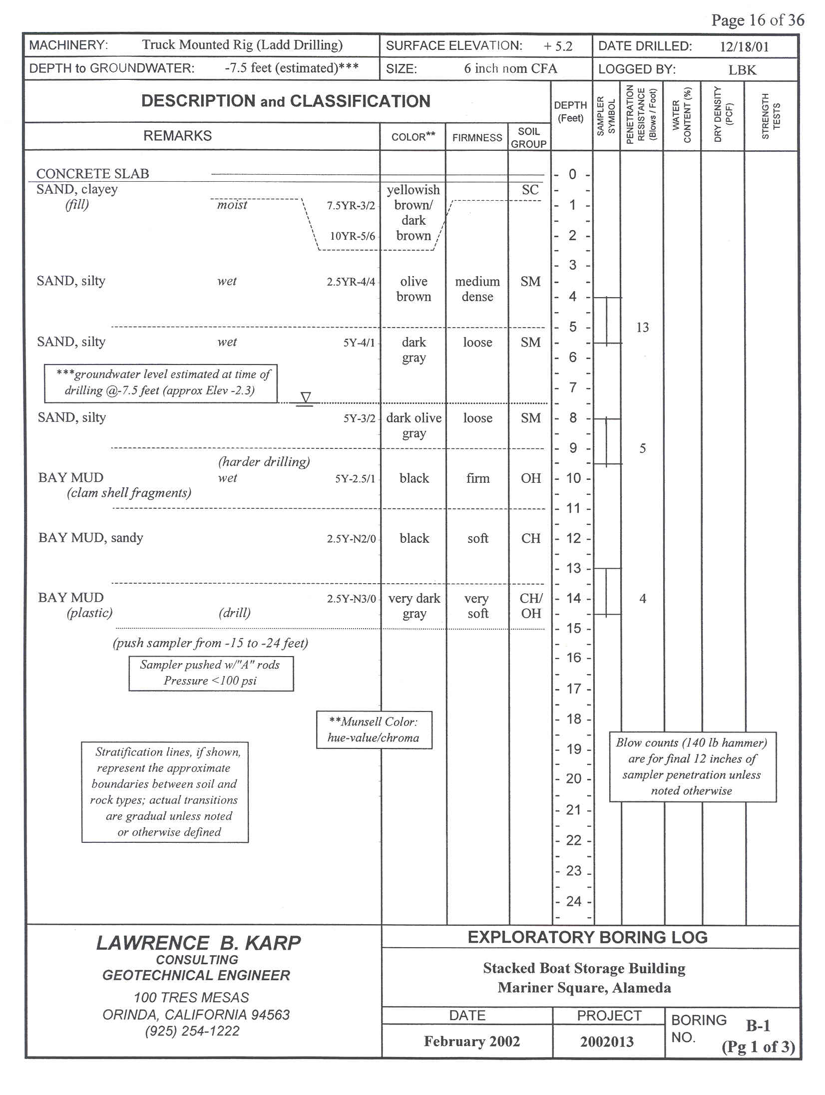
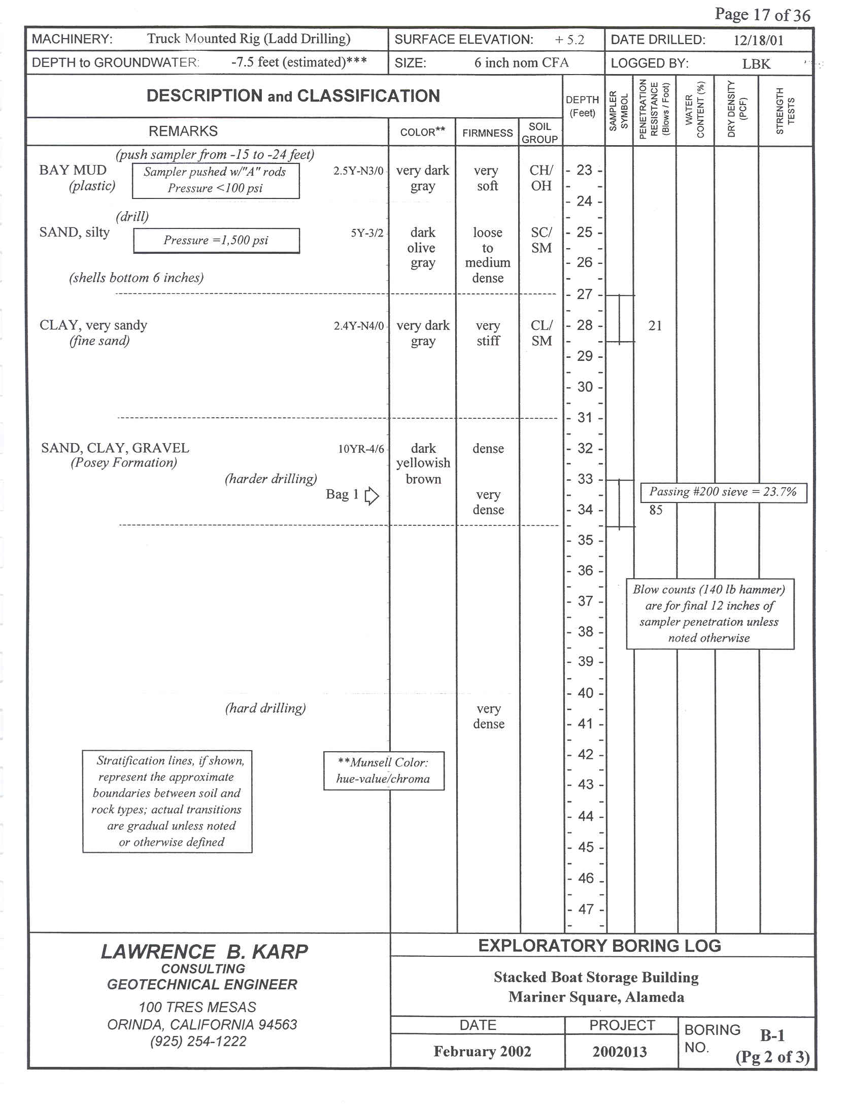
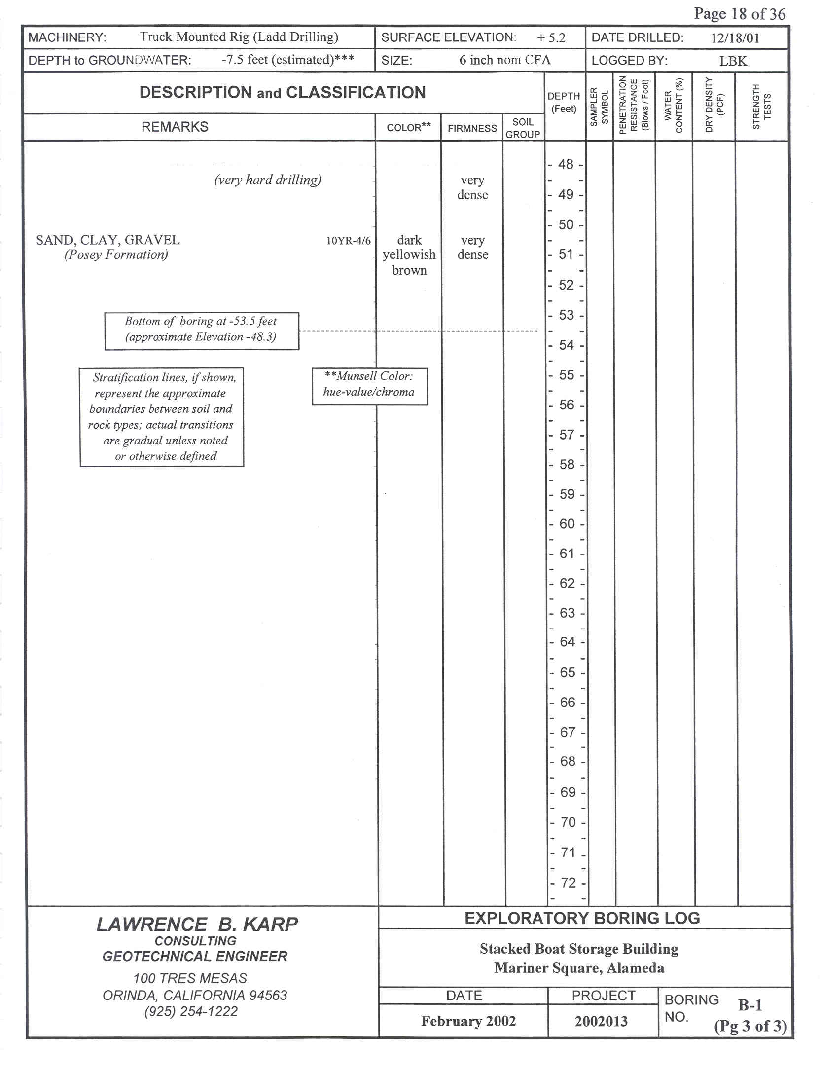
| |
 |
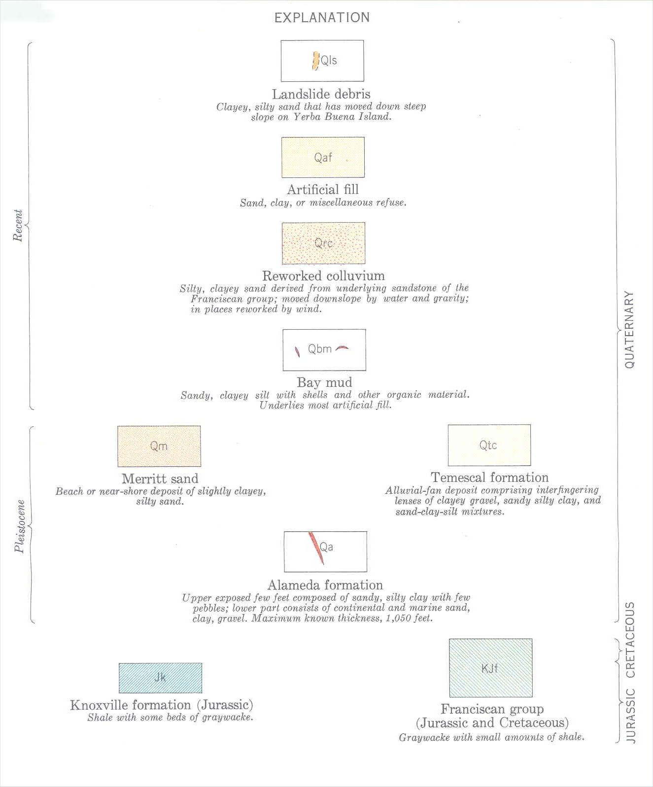
| Radbruch,
Dorothy H., 1957; “Areal and Engineering Geology of the Oakland
West Quadrangle”, Miscellaneous
Geologic Investigations, Map # I-239, Department
of the Interior, United States Geological Survey, Washington DC, Scale
1:24,000 (1" = 2,000'), 1 sheet. |
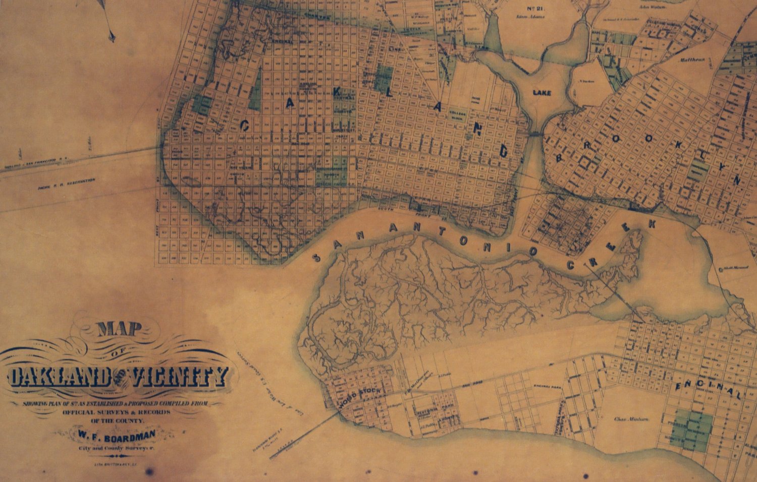 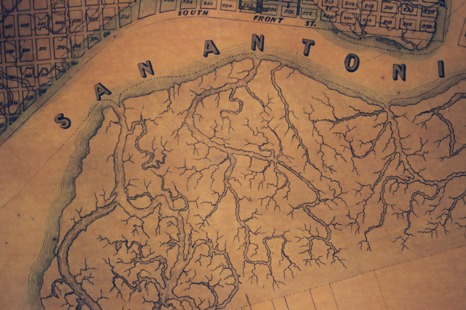 |
| "Map of Oakland & Vicinity" c1895, W. F. Boardman, City & County Surveyor |
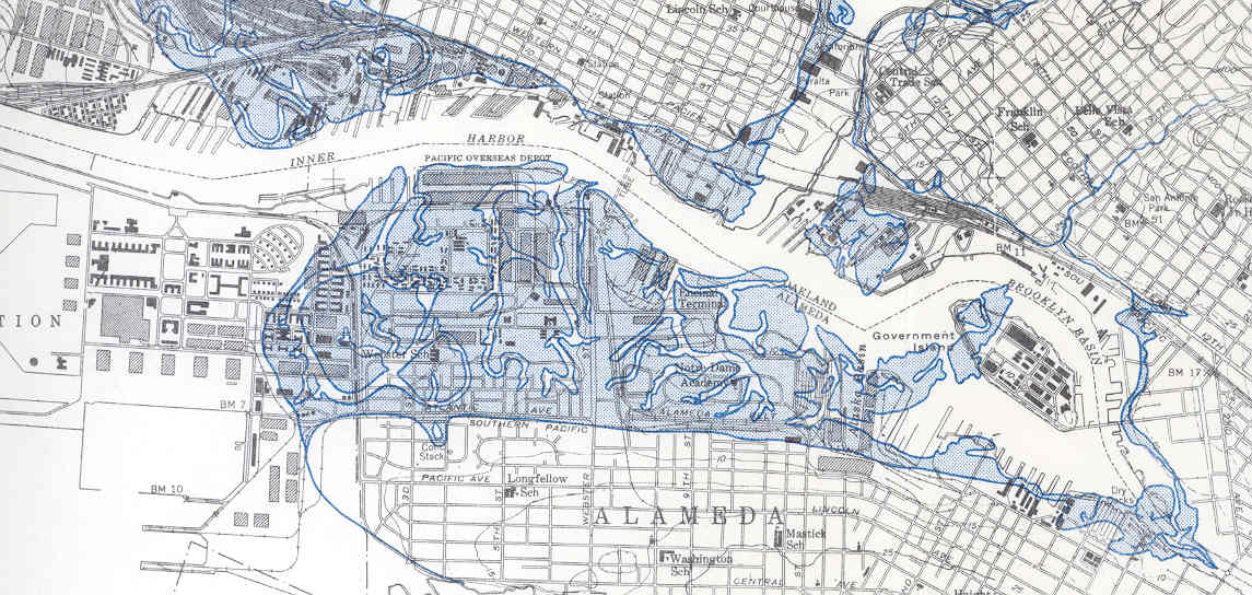  |
| Radbruch,
Dorothy H., 1959; “Former Shoreline Features Along the East Side of San
Francisco Bay, California",
Miscellaneous
Geologic Investigations, Map # I-298, Department of the Interior, United States Geological Survey, Washington DC, Scale 1:24,000 (1" = 2,000'), 1 sheet. |
   |
   |
    |
   |
   |
   |
   |
   |
   |
   |
    |
   |
   |
    |
   |
    |
    |
   |
   |
    |
   |
    |
    |
    |
   |
    |
    |
     |
   |
   |
    |
   |
    |